Like the Manhattan Community Board 1 Dec 22-2020 resolution there are good recommendations here but neither item goes far enough in protecting Governors Island. That would require calling for complete withdrawal of the current rezoning proposal.
– Download the PDF HERE
– Skip to the recommendation text
Manhattan Borough President Gale A. Brewer
Recommendation on the ULURP Applications No. 210126ZRM and 210127ZMM Governors Island Rezoning – South Island
by Trust for Governors Island and NYC Small Business Services (SBS)
PROPOSED ACTIONS
The Trust for Governors Island (the “Trust” or the “Applicant”) and NYC Small Business Services (“SBS” or the “Applicant”) are seeking a zoning map amendment and a zoning text amendment to allow for development on the southern section of Governors Island.
The Applicants propose the following actions:
a) Zoning map amendment to extend the Special Governors Island District to the southern section of Governors Island (the South Island) and to rezone the R3-2 district within the South Island to a C4-1 district; and
b) Zoning text amendment to modify Article XIII, Chapter 4 to establish the existing Special Governors Island District as the North Island Subdistrict of the Special Governors Island District, to establish a new South Island Subdistrict of the Special Governors Island District, comprised of an Eastern Subarea, Western Subarea, and Open Space Subarea, and to establish new provisions applicable to the South Island Subdistrict.
These proposed actions are intended to facilitate development in the Eastern and Western Subareas while reserving the remaining area of the South Island for open space, recreational, water-dependent and other related uses. The Trust has also expressed an intention to attract a climate research center as an anchor tenant for the new development. Taken together, these plans are part of the Trust’s goal to make Governors Island both a City resource that is open year- round, and to also become financially sustainable.
BACKGROUND
From the early years of the Republic and until 1996, Governors Island operated as a U.S. military asset in various capacities. The island was decommissioned as an Army base in 1965 and was then used as a Coast Guard base until 1996 when the facilities were closed by the Federal government as a cost saving measure. At the announcement of its closure in 1996, the New York City Landmarks Preservation Commission designated the area north of Division Road as the Governors Island Historic District, which had already been designated as a National Historic District in 1985. In 2001, President Bill Clinton designated 22 acres of Governor’s Island, an area which included Fort Jay and Castle Williams, as Governors Island National Monument, transferring ownership and stewardship of that portion of the island to the National Park Service. In 2003, the Federal Government sold the remaining portion of Governors Island— including South Island, which is the site of this proposed rezoning—to the State of New York. This action led to the founding of the Governors Island Preservation and Education Corporation (GIPEC), which would eventually become the Trust for Governors Island. The goal of the Trust is to maintain its use as a public asset and guide its future development.
The deed that was transferred to the GIPEC includes restrictions on the future use of Governors Island and requires that the majority of the island would be reserved for open space and public benefit uses. The island must have at least 40 acres of public open space, at least 20 acres reserved for educational uses, and at least 30 acres reserved for a variety of additional public benefit uses, which in addition to further open space could include museums and historic sites, surface and water transportation uses, or nonprofit cultural facilities. The deed also outlines potential development under several categories, including entertainment facilities, hospitality uses, commercial office space, health facilities, and cultural facilities. In addition, the deed prohibits a number of different uses, including permanent residential, manufacturing or industrial uses, gambling, and off-island electrical power generation. These restrictions are in place for fifty years, beginning either on the date of adoption of a Governors Island master plan for development, or December 31, 2012, whichever came first. Since the Governors Island Park and Public Space Master Plan was adopted in 2010, residential restrictions, among other restrictions in the deed, would expire as early as 2060.
The first phase of redevelopment began in 2010, with the release of the Governors Island Park and Public Space Master Plan, the transfer of the island to the City of New York, and the founding of the Trust. The Park and Public Space Master Plan was intended to guide the open space improvements that would transform the island into vibrant parkland and improve the resiliency of the island with topographic changes that would raise much of the park out of the 100-year flood zone. Development areas on the South Island were intentionally omitted from this plan to allow for development during subsequent phases.
The Office of the Deputy Mayor for Economic Development issued a Final Generic Environmental Impact Statement for the Phased Redevelopment of Governors Island in 2011 that analyzed the first phase of improvements included in the Park and Public Space Master Plan, and additional, later phases which included further planned open space improvements, the adaptive reuse of existing historic structures on the North Island, and the eventual planned development on the South Island, designated in the Park and Public Space Master Plan.
In 2013, the North Island was rezoned with the creation of the Special Governors Island District1. The Special Governors Island District, which was intended to protect the historic characteristics of the North Island, while introducing commercial uses, was mapped over the R3- 2 zoning district that encompassed all of the island at the time.
1 New York City Zoning Code, Article XIII, Chapter 4
PROPOSED DEVELOPMENT
Area Context
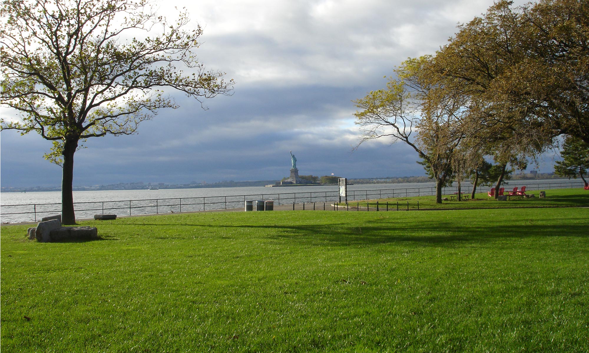
Governors Island is a 172-acre island located in New York Harbor. While it is considered part of the borough of Manhattan and Manhattan Community District 1, it is geographically located between the boroughs of Manhattan and Brooklyn. The eastern coast of the island is near Brooklyn Community District 6. There are several other islands nearby in the harbor, including Ellis Island, Liberty Island, and Robbins Reef.
Access to Governors Island is provided by ferry service during the months of park operations, which run from May 1 through October 31. During the 2020 season, COVID-adjusted service was provided from Battery Maritime Building at 10 South Street in Manhattan and from Red Hook/Atlantic Basin in Brooklyn. Typically, access to the ferry in Brooklyn is provided from Atlantic Avenue Brooklyn Bridge Park – Pier 6 and in Manhattan from Battery Maritime Building at 10 South Street. Tickets from both locations are $3 for adults but are free for visitors ages 12 and younger, seniors age 65 and older, IDNYC holders, current and former military service members, New York City Housing Authority (NYCHA) residents, and Governors Island members.
Site Description
Governors Island is comprised of one zoning lot (Block 1, Lot 10) and is divided into a North Island and a South Island, the border of which is considered to be Division Road. Currently, the entire island is mapped as an R3-2 zoning district, which is a low-density residential district. The existing zoning allows a maximum FAR of 0.5 for residential use, and a FAR of 1.0 for community facility use.
The North Island, compromised of approximately 93-acres north of Division Road, includes the Governors Island Historic District and is the home to five individual landmarks: Fort Columbus (Fort Jay), Castle Williams, the Commanding Officer’s Quarters, Post Hospital, and Governor’s House. Governors Island National Monument is also located within the North Island. Current uses and tenants in buildings within the North Island include the New York Harbor School, the Lower Manhattan Cultural Council (LMCC), offices for the Trust, artist studios, other cultural uses, and commercial uses including various food vendors. There is a day spa currently under construction and the Trust has indicated that additional commercial and new cultural uses will be introduced in currently vacant buildings.
The North Island is zoned R3-2 and is governed by the Special Governors Island District. The special district zoning text modified the R3-2 zoning district to allow for some commercial uses up to an FAR of 1.0. Development is also overseen by LPC since this portion of the island falls under the Governors Island Historic District.
The South Island, the site of the proposed rezoning, is the approximately 79-acre area south of Division Road. In addition to a number of vacant buildings that will be demolished as a part of the redevelopment plan, the South Island has a significant amount of public open space. The South Island is zoned R3-2 but is not part of the Special Governor’s Island District. As such, some of the uses that are permitted on the North Island are not allowed on the South Island.
The “Development Site” located within the South Island is comprised of the Western Subarea and the Eastern Subarea, located on the western and eastern shores of Governors Island. The Western Subarea is approximately 6.1 acres and the Eastern Subarea is approximately 26.8 acres. The remainder of the South Island is the Open Space Subarea, which is not included in the Development Site.
Governors Island includes Pier 101, Pier 102, Yankee Pier, and Lima Pier. Soissons Dock and Soissons Landing are located on the north shore of the island. Tango Pier is not currently operational.
The majority of the Development Site on the South Island is located within the 1 percent annual chance flood plain, as is the waterfront on the North Island. A small portion of each Subarea is also located within the 0.2 percent annual chance flood plain. The raised portion of the parkland completed in accordance with the Public Space Master Plan on the South Island is above the floodplain.
Project Description
The intention of the proposed rezoning is to enable Governors Island to produce enough revenue to offset operational costs and maintain the island as a year-round resource, including the maintenance of open space and the historic buildings. At present, the island operates May through October.
The proposed rezoning would allow up to 4,275,000 square feet of commercial and community facility uses within the Western Subarea and the Eastern Subarea. These subareas are further divided into parcels E-1, E-2, E-3, and E-4 in the Eastern Subarea and Parcel W-1 in the Western Subarea. The allowed uses within the Development Site include those uses currently allowed under the Governors Island Special District, as well as a few other use groups. Additionally, the Trust has also proposed that an education or research institution dedicated to climate and sustainability study would serve as an anchor institution. In support of that institution, the Trust has proposed that the zoning must also be amended to allow for dormitories and faculty housing, space for convening and hospitality, commercial uses, and cultural uses.
The remainder of the South Island, including South Island Park, would be restricted to amenity uses allowed within open space, further restricting what is allowed in open space now. This includes use groups 4, 6, 13, and 15, and a 25 foot height restriction for all amenity uses and a 35 foot height restriction for open air theaters.
The zoning changes proposed are specifically a Zoning Text & Map Amendment to extend the Special Governors Island District and rezone the South Island from R3-2 to C4-1 and to add additional allowed uses on the island within the Development Site.
Additional open space is proposed within the Development Site. The esplanades between the Western Subarea and the water and the Eastern Subarea and the water are proposed to be widened. Additionally, within the Eastern Esplanade, further open space will be created between parcels in pedestrian paths and at the proposed Yankee Pier Plaza. In total, the proposed zoning would create an additional 6 acres of public open space.
The proposed development of the South Island is also intended to allow for increased ferry access. The proposed Yankee Pier Plaza would be required by the proposed zoning text to be at least 25,000 square feet. That plaza is intended to be a reactivation of the Yankee Pier as the primary ferry terminal on Governors Island. The Trust also plans to increase ferry service to year-round service and accommodate increased capacity through improvements at Yankee Pier. The Trust has stated that ferry service from Manhattan to the current terminal on the north shore will not be reduced or terminated.
In 2020, the City Planning Commission certified the Zoning for Coastal Flood Resiliency text amendment application. That application is part of a citywide, multi-agency effort to improve climate resilience in New York City. The Trust has indicated that it will work with the New York City Department of City Planning in order to study how this would affect development prior to the start of any construction.
The Trust has committed to Community Board involvement in the RFP planning process and review for the proposed climate center. Additionally, the Trust has indicated that design guidelines for the development of the project will be created with input from a public engagement process.
The Trust projects that by 2050, it will begin to break even, and its total revenue will be projected to increase from the 2020 amount of $5 million to $126 million by 2050.
COMMUNITY BOARD RECOMMENDATIONS
Governors Island is located within the jurisdiction of Manhattan Community Board 1, but the Trust also made presentations to Brooklyn Community Board 2 and Brooklyn Community Board 6 during their outreach for these ULURP applications. The Trust presented to Manhattan Community Board 1 in February 2018 and September 2018, to the Land Use Committee in September 2020, October 2020, November 2020, and December 2020, and to the Environmental Protection Committee in January 2021. The Applicant also presented to Brooklyn Community Board 2 in March 2018, Brooklyn Community Board 6 in September 2018, and to the Brooklyn Community Board 6 Waterfronts Committee in December 2020.
Manhattan Community Board 1 held a public hearing on November 9, 2020.
During their December 22, 2020 meeting, Manhattan Community Board 1 voted to disapprove ULURP applications No. 210126ZRM and 210127ZMM by a vote of 26 in favor, 3 opposed, 7 abstentions, and 2 recusals unless certain conditions are met, which are summarized below:
Use and Open Space Regulations
The zoning must further limit the allowable uses within the Open Space areas and Open Space Subareas including the removal or amendment of Use Groups 12, 15 and 18, including but not limited to amusement uses, permanent residential, non-maritime industrial uses, sewage removal, marine transfer stations, and private beaches. Also, the zoning and/or Deed must be amended to prohibit permanent, long-term housing uses in perpetuity. Regulations set or recommended in the city’s Waterfront Revitalization Program and the Waterfront Alliance Maritime Activation Plan should be followed.
Environment and Sustainability
The Trust must further commit to a self-powered, off-grid or near off-grid environmental self- sustainability, or near self-sustainability within 3 years of inception and climate impacts of large- scale development must be further studied.
Density, Floor Area Ratio (FAR), Height, Bulk, Parking Regulations
The zoning must be amended to reduce the density, height and bulk for the development on Governors Island. Specifically, the height of buildings should be limited to 125 feet and urban design and architectural guidelines for development on the island must be provided.
Financial Considerations
Community Board 1 has requested that detailed pro forma financial modeling for the development as well as alternative development scenario be shared with the public.
Public Engagement & Oversight
The Trust should incorporate a Community Board comment period for all CPC authorizations for zoning changes and should receive notices for any commercial uses over 7,500 square feet. Additionally, the RFP process for future tenants, should include involvement from the Community Board.
BOROUGH PRESIDENT’S COMMENTS
Governors Island is an important resource for all of New York City, and especially the borough of Manhattan. The Trust deserves our gratitude for reimagining the island as a place of respite, recreation, and discovery that millions of people have come to love. During its current months of operation, New Yorkers greatly benefit from the open space and cultural assets, which is why it is so important to make sure any future development enhances those existing assets while preserving the island as a place for everyone.
I recognize that the Trust faces significant long-term financial challenges that must be addressed in order to preserve the island as a beloved public amenity. I am committed to agreement on a
No. 210126ZRM and 210127ZMM – Governors Island Rezoning – South Island Page 7 of 9
plan that includes a center for climate research and addresses the financial challenge, but does not place too much emphasis on commercial development or alter the pastoral character of the island.
I appreciated the thorough comments and conditions included in the recommendation provided by Manhattan Community Board 1. Additionally, I was happy to hear that the Trust committed to changes in their proposal in response to some of those concerns.
These changes included modifications to the permitted uses in the Open Space Subarea in which the following changes were made:
- All uses in Use Group 15 will be removed;
- All uses in Use Group 13 will be required to be open to the sky; and
- Use Group 12 “eating or drinking establishments with entertainment and allowing for a capacity of more than 200 persons, or establishments of any capacity with dancing” will be removed and replaced with Use Group 6 “eating or drinking establishments with entertainment, but not dancing, with a capacity of 200 persons or fewer”.
The following changes were made to the proposed permitted obstructions:
- The height limit for any structures in the Open Space Subarea will be reduced from 35 feet to 25 feet, except for structures associated with open theaters.
The Community Board also expressed concerns about ambiguity in how the “base plane” is defined that might allow for additional height in a development. The Trust has committed to fixing this issue with DCP by clarifying the zoning text.
The Trust has also committed to ensuring CB1’s participation in the RFP process for the anchor climate institution that they hope to attract. The Trust has agreed that after issuing the RFP in 2021, they will brief CB1 on the finalists and solicit their feedback before selecting a winning respondent.
However, my primary concern is how the potential height of future development would affect the island. The proposed allowable height, which ranges from 200 feet to 300 feet, is too significant. Buildings of that height would cast shadows on the remaining open space on the island, and irrevocably change its character. I believe the proposed building within the Eastern Subarea could be reduced significantly in height and remain economically viable, especially when there has been recent evidence that shorter buildings have not had trouble attracting tenants.2 To protect what makes Governors Island attractive in the first place, the height of any future structure must be reduced.
All New Yorkers are grateful for the Trust’s success in making to the island as accessible as possible. Transitioning Governors Island to a year-round amenity is an admirable goal and I support it. However, free ferry service currently provided for children, seniors, IDNYC holders, current and former military service members, and New York City Housing Authority (NYCHA)
2 “On the Hunt for Office Space, Companies Stay Low to the Ground”, The New York Times
residents must be preserved. Additionally, pier improvements and expanded ferry service must be included as commitments to expand access further.
As I stated above, I support the idea of a climate research center but I share the concerns of CB1 that there is not sufficient demonstrated need or interest in a center at this location. The ongoing pandemic has significantly changed the way that research and higher education are conducted, and I’m worried the organizations that might want to locate here will not be nonprofits or public benefit-minded groups. I believe that it would be important for the Trust to further demonstrate that there is sufficient interest and need before moving forward. I encourage the Trust to pursue an RFEI process with rigorous public engagement in advance of the proposed RFP to identify the feasibility of the center.
I am also seriously concerned about the climate resiliency of Governors Island. I support the commitment by the Trust to aim for a net-zero climate impact. However, the existing and predicted sea level rise and storm surge levels are not addressed by this proposal. With the inclusion of residential uses on the island, even if only for dorms and faculty housing, the issue of resiliency becomes even more important. The additional requirements now included in the recent DCP-sponsored Zoning for Coastal Flood Resiliency also need to be taken fully into account before the project is approved. The Zoning for Coastal Flood Resiliency text amendment which will protect historic and special zoning districts, maintain a vibrant and consistent street wall, and prioritize and fully facilitate resilient retrofits of existing buildings will apply to the entire city. The proposal for Governors Island must demonstrate how that text amendment applies to the historic buildings, monuments, infrastructure, and new construction.
In the course of developing the island, it is essential to make sure that the needs of existing tenants are met. In particular, I am supportive of the Harbor School’s need for additional space and a pool that is appropriate for certification for marine diving and lifeguard training, ensuring the continuing support of composting by Earth Matter Inc., and the need for turfed fields with lighting that are primarily reserved for youth leagues and public schools.
The proposal combines many different goals. Some are relatively near term; others are acknowledged to require decades of investment. Since the overriding goal of this rezoning is to ensure that the Trust has enough revenue for proposed development and to meet recurring costs, we must ensure that aspects of the project that service existing needs such as the facilities for the Harbor School and other public amenities are frontloaded in the project. The financials of the project must be scrutinized carefully. I am concerned that even with the full proposed build-out, the island will not reach a break-even point until 2050. During the next 30 years, much could happen, including a Sandy-type storm event that could slow or hinder construction of new buildings and set this timeline back by many years. I encourage the Trust to seek other forms of funding, including federal money, that could address these challenges.
Any development that occurs on Governors Island must be done in a way that preserves what makes it special now. The island is one of the few places where New Yorkers can escape the city and connect with nature. While the goal of furthering climate research is laudable, and I acknowledge that revenue from the development of new facilities is necessary, I believe that
No. 210126ZRM and 210127ZMM – Governors Island Rezoning – South Island Page 9 of 9
these goals can be achieved without a major impact on the pastoral qualities that now make this island such a magnet for the public.
The following concerns show that many key issues remain unresolved. For that reason, I cannot support this application its present form.
BOROUGH PRESIDENT’S RECOMMENDATION
Therefore, the Manhattan Borough President recommends disapproval of ULURP ApplicationsNo. 210126ZRM and 210127ZMM unless the Applicant meets the following conditions:
- At a minimum, in addition to removing Use Group 15, require all uses in Use Group 13 to be unenclosed, and replace Use Group 12 with Use Group 6, as well as limit height of structures from 35 feet to 25 feet, except for structures associated with open theaters in the Open Space Subarea, in accordance with changes made to address concerns made by Community Board 1, and work toward redefining “Open Space Areas” and “Open Space Subareas” as “public parkland” in the zoning;
- Limit the height of buildings within the Development Site to 125 feet;
- Expand direct waterfront access, and incorporate natural shorelines along with plans for esplanades and elevation;
- Commit to working with the Department of City Planning to adjust all planned development in compliance with Zoning for Coastal Flood Resiliency requirements;
- Commit to an RFEI process for an anchor tenant in advance of the RFP in order to gain a better understanding of tenants expressing interest;
- Amend the proposed zoning to allow for a Community Board 1 comment period to be incorporated in all CPC Authorizations, Certifications, waivers, allowances, or any additional changes to the zoning;
- Make the accommodations needed to allow for the construction of a pool and the acquisition of additional building(s) for classrooms, a gym, and an auditorium on the North Island for the New York Harbor School;
- Amend Use Group 18 to explicitly allow for composting in order to enable Earth Matter NY Inc. to continue their operations in perpetuity; and
- Upgrade existing athletic fields with lighting and artificial turf, and expand field space on Governors Island.